Routes & Navigation
Easily find the best route to a desired destination with precise data and live traffic. Regardless whether your users are online or offline.
Routes & Navigation
Help your users get their best way with precise data and live traffic. No matter whether they are online or offline.
0
million
km of roads
Everywhere you go, create using accurate navigation data.
0
million
updates every month
Rely on precise, up-to-the-minute location data. Built by more than 9 million contributors.
0
billion
active users per month
Map confidently and join more than a billion others that use OpenStreetMap every month.
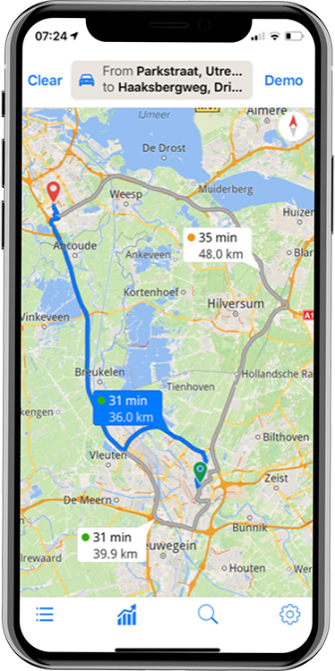
Set up optimal routes to decrease costs and boost user experience
Set up multi-point routes using accurate data on distances between points and expected travel times. Get recommended routes for up to 25 waypoints that take into account both predictive and live traffic events. Thanks to route optimization and live localization of trucks, drivers can avoid traffic jams, and you can optimize fleet usage, schedule idle trucks for maintenance and reduce late deliveries.
Even during peak hour traffic, maintain your work environment moving
Know real traffic situations in advance and pick quicker routes, or redistribute deliveries to employees. Predictive workforce modeling can be used to anticipate possible road congestion problems and schedule deliveries for a time when traffic flow is less slow.

Global coverage
The Magic Lane Maps, Location & Navigation Platform includes the best available Open Data globally and now includes more than 2,000 open data sources, including OpenStreetMap, elevation data, satellite imagery, points-of-interest, address data, public transport data, traffic, weather and Wikipedia.
Features
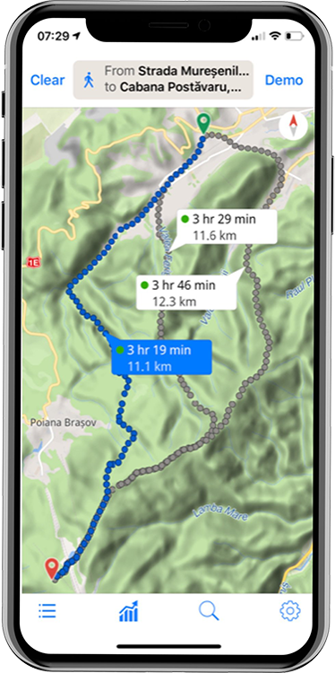
Instructions
Get instructions for taking public transportation, biking, driving or walking. Derived from real traffic, calculate current or future travel times.
Distance Matrix
Enable different destinations to be calculated from a single start or origin.
Roads
An easy way to expand your trips’ vehicle routes is to discover which roads have been driven on and which points of the vehicle route a vehicle has traveled.
Multi Modal Routing
Because we developed the entire platform, you can connect public transport routes with perfect pedestrian routes. Or you can guide your customers with a car route to parking and provide perfect pedestrian navigation instructions to your restaurant.
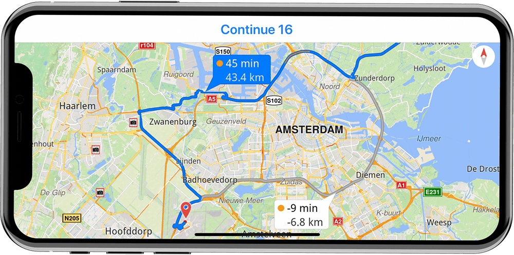
Traffic aware rerouting
Traffic information is crucial for your navigation experience. Our smart algorithms make possible intelligent user interfaces.
Lane Guidance
Cristal clear Lane Guidance to make sure you don’t miss a turn and can comfortably follow the road when you need to.
Speed Limits
In case you missed a speed sign, we will show you the speed limit always on screen. And in case you’re speeding, a warning message can be played.
Speed Cameras
The free Speed Camera service makes sure you avoid speeding tickets.
Online & Offline
The Magic Lane Navigation solution allows you to calculate routes and provide turn-by-turn navigation entirely online or entirely offline when the maps for the region have been downloaded. Crucial for solutions where you simply can’t rely on an internet connection.
Start using Routes & Navigation
Start using Routes
Complementary products
Maps & 3D Scene
Bring interactive customizable real-world maps to your users in 3D. No matter whether they are online or offline.
Locations
Explore the world with rich location info for over 98 million points of interest, including 4 million Wikipedia articles.

AI Dashcam
Dashcam and Advanced Driver Assistance modules for Android and iOS. Smart collaborating software modules using deep learning and Artificial Intelligence.